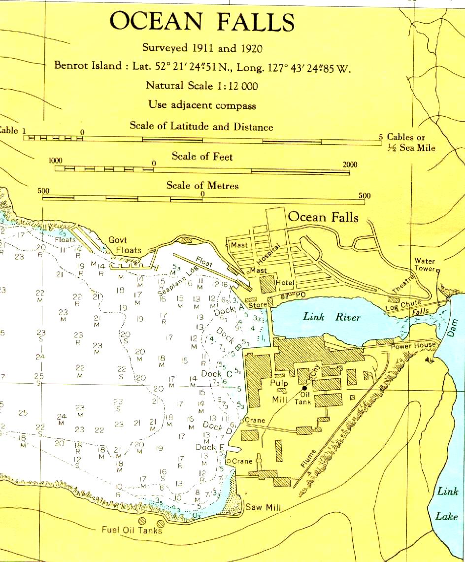
ocr: OCEAN FALLS Surveyed 1911 and 1920 Benrot Island : Lat. 52-21'24351N., Long. 127943/24-85W. Natural Scale 1:12000 Use adjacent compass able 1 Scale of Latitude and Distance HHH HE ) Cables or % Sca Mile Scale 1000 of Feet 2000 500 Scale of Metres 500 Ocean Falls Floats Govt Mast 20 Floats 23 R Water 21 19 M14 R EL M - L 4 M oa - Mast Towerg H 22 17 M 23 M R 22 21 M 21) 18 M M 19 17 R Ecourie M 15 - M 13 M 13 MI 12 12162 16 Dock; 3. ETS 33: Stores Hotel SEOPO Link River Log E Chute Falls DEn - 13, 3 23 20 17 121/4; 0 a House) R 23 S M Power M 20 24 M M 18 15 R 15. 22 22 Dock c5 25 M S 120 17 14 ...