MAIN BAR

With the main bar you can navigate on the Amiglobe
map.
1. Arrow 
Change the cursor to an arrow (default). The arrow cursor
permits country selection.
2. Hand 
Change the cursor to a hand. Press the left mouse button, move the cursor
and release the mouse button to drag the map.
3. Zoom in selected area 
Zoom in the map. Draw a rectangle on the map by
pressing down the left mouse button, then move the mouse, and release the
left mouse button. The map will be redisplayed according to the new zoom
level.
4. Zoom in 
Zoom in the map. The map will be redisplayed according
to the new zoom level.
5. Zoom level selector 
Select the desired zoom level with this slider.
6. Zoom out 
Zoom out the map. The map will be redisplayed according
to the new zoom level.
7. Reset 
Reset the zoom level to the entire world.
8. Info 
Display information about the current selected country.
The info window shows more than 160 different
data about each country. Click here
9. Map projection 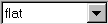
Select the map projection to choose how the map
will be displayed. There are 4 projections:
flat or "plate carrée": Coordinates of each
point (longitude, latitude) are converted by homothety, in screen coordinates.
Lambert: The latitudes are converted into screen
coordinates by calculating the sinus of the angle latitude 0 - Earth's
centre - considered point's latitude.
Mercator: The Mercator Map was developed in 1569
by cartographer Gerhard Kremer, whose surname (meaning "merchant" in English)
becomes Mercator in Latin. It has since been used sucessfully by sailors
to navigate the globe since and is an appropriate map for this purpose.
spherical: The Earth as it would appear from space
10. Back/Forward /
/ 
The backward button shows the map with the previous
zoom level. For example, if you were browsing Europe, and you zoom on Germany,
the back button will show the Europe map. The forward button will show
the Germnay map again.